
This hike is 2 miles total round trip! Featuring two waterfalls and the Chattooga River! It is an out and back. An easy trail to hike, it needs a good bit of detail so there is no confusion to newcomers of this trail. Let's get you and your family ready for adventure!
1.) Getting There - The trip there is quite easy. Located in the Sumter National Forest in Oconee County, SC, these falls on this one short trail can be located easily with your Google Maps GPS. Just type "Lick Log Falls" into your GPS and it will take you straight there. Some notes about what to expect as you near the location. Your last leg of the drive will end on a Dead End gravel road. You GPS will likely tell you, "You have arrived," in the middle of this gravel road. Just keep going and you will undeniably end your drive in a dead end gravel parking lot with an obvious trail-head. I've taken some pictures even so to terminate any possible confusion on this drive in.

The first possible point of confusion as you journey down the Dead End gravel road to park is this private drive on the Left. The road is named "Pribyl" and you should not go down it. Just keep straight.

You will soon then encounter this view. The "Private Drive" is on the left, keep right (or straight, technically) and you will soon be in the parking lot. Reminder the GPS will tell you that you have arrived prematurely. Keep going until you can go no further. You will know without a doubt it is where you are supposed to park when you see it.
2.) The Trail-Head - Now you are parked and ready for your adventure. (No bathrooms so find a tree). You will immediately see two different trail-heads. Which one do you take? Not to fret. The trail on the left with the "kiosk" of maps and notices is the one you will take. Here is a sign for the start of your trail:

This is your sign. Your trail begins directly to the right of it.

This is a map that is posted at the trail-head kiosk. Standing in front of this map, you are in "P" (parking). It's not an awesome map, but the trail is so well marked its not truly necessary. Still, taking a photo of it before you get started is a good choice, just in case.
3.) Hiking the Trail: The trail is beautiful and peaceful. It is full of Mountain Laurel, creeks, and a total of 3 wooden foot bridges. The trail begins with white trail blazes. (White rectangles painted on tree trunks as you proceed). Follow these as you journey to the first waterfall on your hike. The first waterfall is Lick Log Falls. It is an easy hike to this first waterfall. An easy hike for children as well. After walking over two of three total wooden foot-bridges, you will soon come to a fork in the hike that is very well marked. You will see a trail continue ahead of you and a trail start downwards on the left. Go downwards on the left. There is soon a post marked :Lick Log Falls" so you will definitely know you are going the correct way. After your short descent, you will hear and see the beautiful Lick Log Falls where you can pause to play and pic-nic! Here are some photos and details:

Above & Below are 2/3 wooden foot bridges. The first 2 are crossed as you approach Lick Log Falls


This is the fork I mentioned just above in which the trail with white blazes you are walking stops and now you begin following green blazes. The post here above is marked, "Chattooga Foothills North." Do not continue on this trail. You are now going to turn left where you will descend and soon see the below pictured post, "Lick Log Falls."

Here we have Lick Log Falls:

Beautiful photo and it still doesn't do the falls justice! So peaceful!
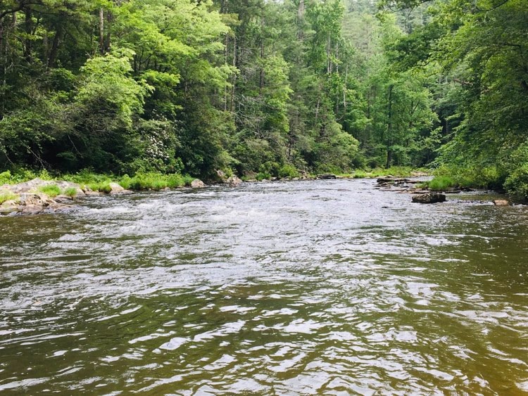
Ok, now when you are ready to proceed to the second falls on the hike, "Pig Pen Falls," do NOT come back the way you came, just keep on past the first falls to the very obvious next third wooden footbridge. You won't be able to miss it so do not fret! This next description will be difficult to put into words but know that it is not difficult to locate the next falls. After crossing the third wooden foot bridge, continue down the path. You won't go very far until on your right you can both see and hear a large waterfall. (How beautiful!) Walk just a few more feet past full vision of this second waterfall on your right and you will see a steep descent on the right also. My sister saw it and wasn't sure if it was meant to be ventured down or not. Technically, this descent is OFF TRAIL. It is not part of the green blazed trail, however, it has been so well established by other adventurous trail blazers like myself, it is easy access to the Chattooga River beach and the base of the second falls, "Pig Pen Falls." This descent will be the "hardest" part of the trail. It is a steep descent but it is very short. You will climb to the bottom and venture out on to a beautiful sandy beach area with uprooted trunks. This is also a wonderful pic-nic spot. It is nice for swimming IF you are a strong swimmer. It is a river with a current after all. Be smart and use your common sense. My sister was able to swim across with all four of her children (ages 5-10). They were all capable of making that strong swim solo but obviously and of course still with the close body of my sister. The river at this spot is not deep but in one small spot. If you do swim to the other bank, there is a large blackberry bramble and it is only just beginning to ripen! How lovely! We love eating wild blackberries. With my two year old, I placed her in her "puddle jumper" and we stayed in shallow waters near the base of the falls and dug in the sand with a shovel. Kids will also be able to climb the fallen tree roots. All 5 kids in my family enjoyed climbing, making tents and huts, swimming, digging, and building with rocks.


We spent about an hour at this spot before heading back. When you do head back, obviously go the way you came, back up that steep incline. (Remember it is short). It is full of roots and trees to hold on to for climbing. My two year old climbed without struggle or complaint. I consider her a seasoned hiker. The entire trail is easy...this part I would rate moderate. I think any average hiker will be able to do this. If you are a mom carrying, you can do this for sure but be prepared to crouch down to avoid limbs knocking heads. Little hikers can do this. Just let them take their time, hold hands if necessary, and give lots of encouragement and overly zealous shouts of praise as they go about it! Now, when you get to the top of that climb, go back to the LEFT. Do NOT go right where the green trail blazes will continue. If you do, you will be hiking forever like you are backpacking. Let me say that again, once you get to the top of the climb back up the side of the mountain from the beach, go LEFT back where you came from. You are heading back towards the first waterfall you encountered and on to the car to leave. You will go over the wooden foot bridge again and the first waterfall will be passed on the right and you will go back up to trail you started on. Go right and you will be all set to follow white blazes once again all the way back to the parking lot.
Enjoy! Happy Waterfall Chasing!


No comments:
Post a Comment